Henry Wood Elliott Maps and Drawings

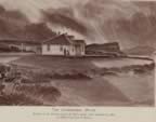
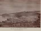
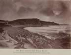
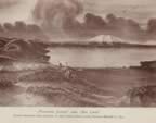
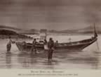
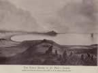
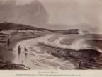
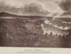
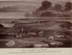
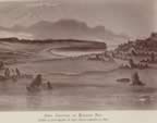
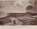
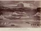
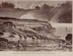
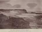
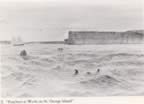
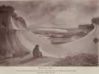
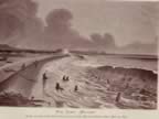
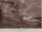
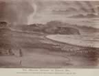
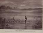
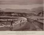
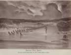
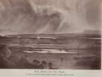
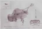
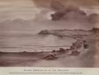
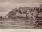
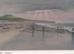
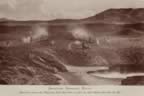
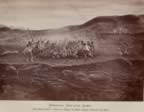
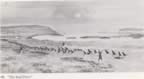
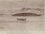
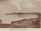
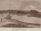
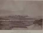
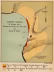
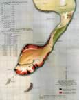
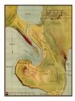
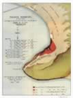
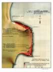
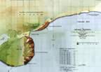
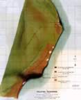
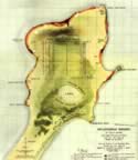
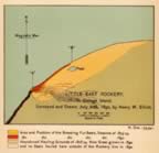
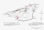
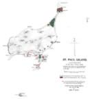
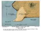
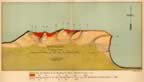
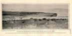
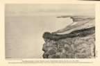
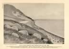
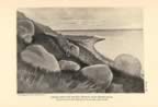
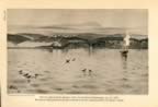
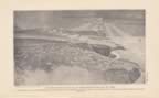
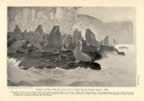
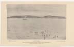
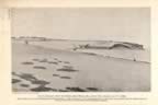
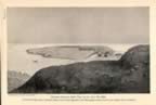
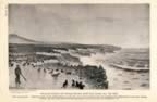
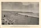
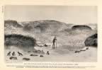
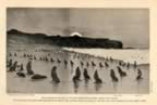
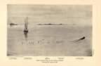
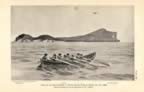
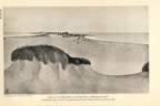
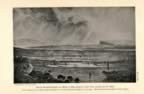
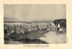
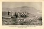
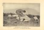
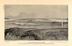
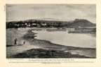
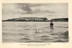
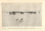
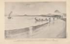
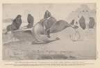
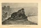
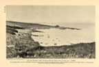
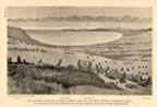
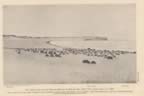
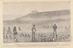
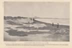
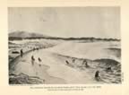
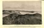
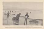
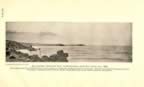
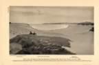
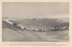
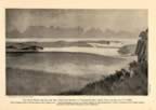
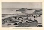
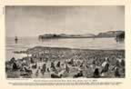
This collection derived from government publications includes Pribilof Islands maps and drawings created by Henry Wood Elliott. In 1872 Elliott, a young artist-naturalist, traveled as a U.S. Treasury Department assistant agent to the Pribilof Islands, assigned to oversee the fur-seal harvest. Mr. Elliott was fascinated by the Pribilof Islands’ natural resources, and in particular the northern fur seal, and took it upon himself to portray the islands’ natural history. Elliott was a skilled artist who applied his talent to his self-determined task. Elliott’s initial studies indicated a herd of approximately four million seals. He revisited the Pribilofs in 1874 and 1876 and concluded from his studies that 100,000 bachelor males per year could be harvested without undermining sustainability, “provided no abnormal cause of destruction occurred.” When Elliott returned once again to the Pribilofs in 1890, he was outraged that the seal herd had been decimated. As a result, he became an untiring advocate for the fur seal. The U.S. government and commercial sealing interests, however, were not yet ready for concepts of managed conservation. In 1905, Elliott, in partnership with U.S. Secretary of State John Hay, drafted a treaty for managing the seal herds. Finally, in 1911, Russia, Japan, Great Britain, and the United States, the four nations most concerned with sealing, were sufficiently shocked and revolted by the indiscriminate slaughter of the seals to sign a treaty outlawing open water sealing and accepting on-shore management of the seal herds by the United States. The Convention between the United States and Other Powers Providing for the Preservation and Protection of Fur Seals, popularly known as the Fur Seal Treaty of 1911, was a landmark agreement. It was the first international treaty to address the issue of wildlife conservation.


Return to Image Gallery Home

Thumbnail drawing of St. Paul Government House. Thumbnail drawing of St. George Village. Thumbnail drawing of East Landing and Black Bluffs. Thumbnail drawing of Polovina Hill and Big Lake. Thumbnail drawing of biadar at Village Cove.
Thumbnail drawing of view of the north shore from Cross Hill. Thumbnail drawing of Lukanin Bay. Thumbnail drawing of northern fur seal rookery at Polovina Point. Thumbnail drawing of reef rookery. Thumbnail drawing of view of English Bay from Zapadni.
Thumbnail drawing of Northeast Point northern fur seal rookeries. Thumbnail drawing of northern fur seal pups at Zoltoi Sands. Thumbnail drawing of northern fur seal hauling grounds at Tolstoi Point. Thumbnail drawing of northern fur seal hauling grounds at Zoltoi Sands. Thumbnail drawing of pelagic sealing off the coast of St. George Island.
Thumbnail drawing of northern fur seals at English Bay. Thumbnail drawing of northern fur seals hauling out on the east shore. Thumbnail drawing of northern fur seals climbing Tolstoi Cliffs. Thumbnail drawing of northern fur seal hauling grounds at English Bay. Thumbnail drawing of Elliott inspecting northern fur seals at Reef Rookery.
Thumbnail drawing of capturing northern fur seals at English Bay. Thumbnail drawing of driving northern fur seals across Zoltoi Sands. Thumbnail drawing of driving fur seals on the Lagoon Flats. Thumbnail drawing of St. Paul Island. Thumbnail drawing of people creeping up on sea lions.
Thumbnail drawing of capturing sea lions at Sea Lion Neck. Thumbnail drawing of northern fur seals at Tolstoi. Thumbnail drawing of shooting sea lion bulls near St. Paul Village. Thumbnail drawing of spearing sea lion cows near St. Paul Village. Thumbnail drawing of the Seal Drive.
Thumbnail drawing of Village Hill as seen from the Bering Sea. Thumbnail drawing of the North Shore of St. George Island. Thumbnail drawing of Village Cove. Thumbnail drawing of killing grounds near St. Paul Village. Thumbnail map of Starry Arteel (now Starya Artil) Rookery.
Thumbnail map of Great Eastern (now East) Rookery. Thumbnail map of Zapadni Rookery. Thumbnail map of Reef and Gorbatch Rookeries. Thumbnail map of St. Paul Village and Lagoon killing grounds. Thumbnail map of Tolstoi Rookery.
Thumbnail map of Lukanin and Kitovi Rookeries. Thumbnail map of Zapadni Rookeries. Thumbnail map of Polovina Rookeries. Thumbnail map of Novastoshnah (now Vostochni) Rookery. Thumbnail map of Little East Rookery.
Thumbnail map of northern fur seal rookeries and hauling grounds. Thumbnail map of northern fur seal rookeries and hauling grounds. Thumbnail map of northern fur seal hauling grounds at Southwest Point. Thumbnail map of North Rookery. Thumbnail drawing of a view of Zapadni hauling grounds and rookery.
Thumbnail drawing of view of the north shore of St. George Island from Staraya Artil bluffs. Thumbnail drawing of Starry Arteel (now Staraya Artil) Rookery. Thumbnail drawing looking down on East Rookery. Thumbnail drawing of St. George Village with a steamer in the foreground. Thumbnail drawing of the north shore and village.
Thumbnail drawing of a view of the east shore of St. George Island. Thumbnail drawing of a group of sea lions. Thumbnail drawing of view of the south shore of St. George Island. Thumbnail drawing of empty hauling grounds at Tolstoi Rookery. Thumbnail drawing of Zapadni Rookery viewed from Cemetery Ridge.
Thumbnail drawing of Polovina Rookery and hauling ground. Thumbnail drawing of old northern fur seal bulls at Polovina. Thumbnail drawing of northern fur seal pups at Zoltoi. Thumbnail drawing of northern fur seals hauling out at Tolstoi Sands. Thumbnail drawing of view of St. Paul Island from the southeast.
Thumbnail drawing of view of the north shore of Otter Island. Thumbnail drawing of view of the Sand Neck and Cross Hill at Northeast Point. Thumbnail drawing of driving northern fur seals near St. Paul Village. Thumbnail drawing of driving northern fur seals near Zoltoi. Thumbnail drawing of the killing gang at work on the Village slaughter field.
Thumbnail drawing of a man skinning a fur seal. Thumbnail drawing of St. Paul Village. Thumbnail drawing of Village Cove and Landing. Thumbnail drawing of St. Paul Village viewed from East Landing. Thumbnail drawing of Walrus Island viewed from the East.
Thumbnail drawing of seabirds breeding on Walrus Island. Thumbnail drawing of loading bundled fur seal skins from the Salt House to the ship at Northeast Point. Thumbnail drawing of adult male fur seals fighting. Thumbnail drawing of an old bull crippled in combat. Thumbnail drawing of Ketavie (now Kitovi) Rookery from Black Bluffs.
Thumbnail drawing of the hauling grounds at English Bay with a seal drive beginning. Thumbnail drawing of desolate hauling grounds at English Bay. Thumbnail drawing of fur seals on the Reef Rookery parade ground. Thumbnail drawing of Lukanin Bay. Thumbnail drawing of hauling grounds at Lukanin Bay.
Thumbnail drawing of the north shore of St. Paul Island, showing abandoned hauling grounds. Thumbnail drawing of empty hauling grounds at Lukannon (now Lukanin) Beach. Thumbnail drawing of abandoned hauling grounds at Sea Lion Neck, Northeast Point. Thumbnail drawing of empty hauling grounds at English Bay. Thumbnail drawing of view of Reef and Gorbatch rookeries from Fox Hill.
Thumbnail drawing of Reef Point and Village Hill from Telegraph Hill. Thumbnail drawing of abandoned hauling grounds at Lukannon (now Lukanin) Rookery. Thumbnail drawing of Ketavie (now Kitovi) Rookery.