 |
|
Topics
|
Island Setting
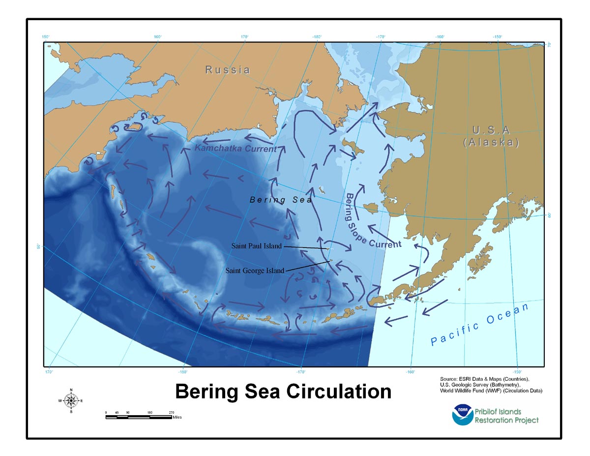
The Bering Sea is a semi-enclosed sea bounded on the north and west by Russia, on the east by mainland Alaska, and on the south by the Aleutian-Commander archipelago. A deep basin (maximum depth 3,500 meters (m)) and continental shelves (<200 m deep) comprise the sea (Stabeno et al. 1999a; Winer 2001, 4–7). The sea’s eastern continental shelf is broad, measuring more than 500 kilometers (km) (Stabeno et al. 1999a). The Pribilof Islands are located on the seaward edge of the eastern continental shelf. To the north, the Bering Sea is connected with the Chukchi Sea and Arctic Ocean through the Bering Strait. In the south, numerous passes, or straits, through the Aleutian-Commander archipelago connect the Bering Sea with the Pacific Ocean (Pavlov and Pavlov 1996). Circulation is strongly influenced by the Alaskan Stream, which enters the Bering Sea through the many passes. The inflow into the Bering Sea is balanced by outflow through Kamchatka Strait. Circulation in the Bering Sea is often described as a cyclonic gyre, with the southward flowing Kamchatka Current forming the western boundary current and the northward flowing Bering Slope Current forming the eastern boundary current (Stabeno et al. 1999a). Around the Pribilof Islands, the current flows clockwise (Stabeno et al. 1999b).
Humans and Bering Sea Resources
|
 |
NOAA created this product in partial fulfillment
of a memorandum of agreement between it and the Alaska State Historic
Preservation Officer. |